On Friday, April 22, billions of people across the globe will celebrate Earth Day. They will commemorate the event by staging rallies, participating in environmental clean-up activities, and pledging to undertake "green" initiatives to protect this precious planet. While that is certainly helpful, it would be even better if we could incorporate "greener" habits into our daily lives. These stunning images taken from space by NASA will serve as a reminder of why making every day "Earth Day" is so important.
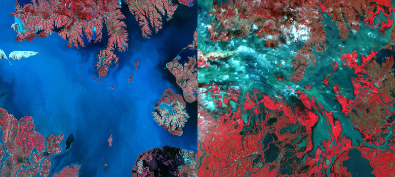
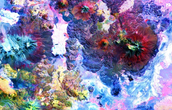
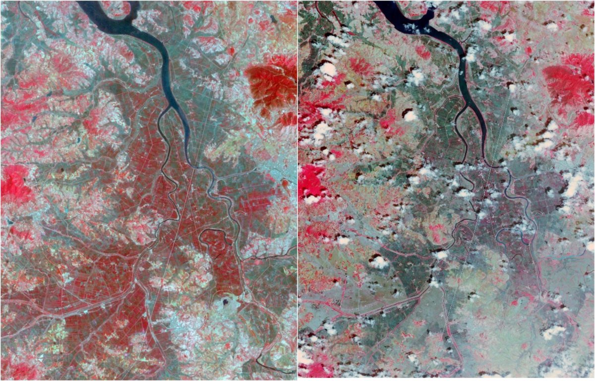
The almost 3 million photos that became freely available to the public earlier this month, are the result of 16 years of work by NASA's Terra spacecraft. Launched on December 18, 1999, the Earth Observing System (EOS) satellite is equipped with a suite of five instruments including Japan's Advanced Spaceborne Thermal Emission and Reflection Radiometer (ASTER). Each is designed to capture a different, albeit complementary, view of Earth. In addition to the images, the sophisticated instruments also collect a total of 72 measurements, enabling scientists to get a complete picture of the planet's climate and the environment.
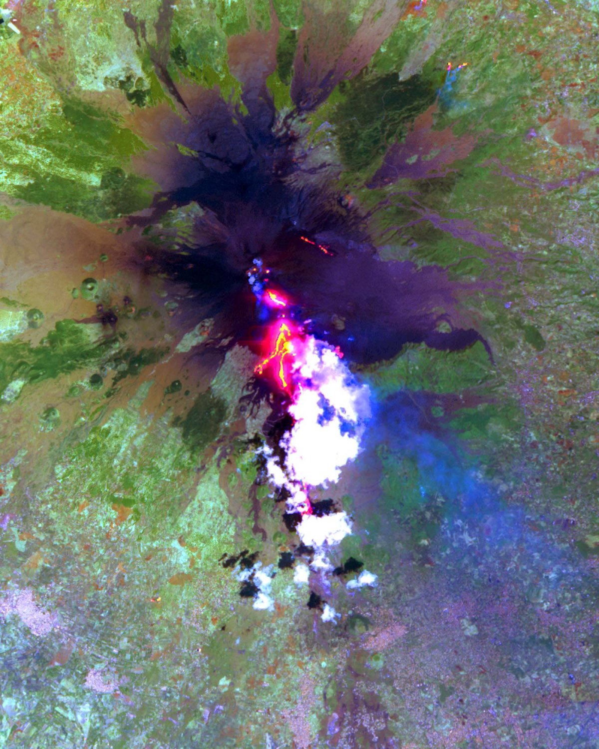
Over the years, Terra has captured many natural disasters as they are happening. These include Iceland's volcanic eruptions, California's bushfires, North Korea's 100-year drought, and the aftermath of the floods in Pakistan. The satellite has also been able to document glacial retreats, evaluate wetlands, observe coral reef degradation, and monitor changes in the surface temperatures of soils and geology.
Hence, in addition to being incredible, the images are also extremely useful for researchers studying the impact of global warming on our planet. However, until recently, scientists had to pay to use them. Now that they are freely available, Michael Abrams, ASTER science team leader at NASA’s Jet Propulsion Laboratory in Pasadena, California, says, " We anticipate a dramatic increase in the number of users of our data, with new and exciting results to come." Hopefully, some of the research will help us find a way to reverse or at least, curb climate change.
Happy Earth Day!
Resources:iflscience.com, news.nationalgeographic.com,zmescience.com
