
If some geologists have their way, world maps will soon be altered to reflect an eighth continent. Dubbed “Zealandia,” the landmass that lies east of Australia covers 1.9 million mi2 (4.9 million km2), or an area larger than the Indian subcontinent. The only catch? Over 94 percent of it is submerged in the southwest Pacific Ocean, with just the islands of New Zealand and New Caledonia visible above sea level.
To be clear, the underwater land is not a recent find. Researchers have known about its existence since 1995, when Bruce Luyendyk, professor of marine geophysics at UC Santa Barbara, discovered and proposed an eighth continent that he called Zealandia. At the time, the area was dismissed as a collection of islands and land fragments, or at the most, classified as a microcontinent — a landmass of continental crust that is not geologically connected to the nearest continent, in this case, Australia.

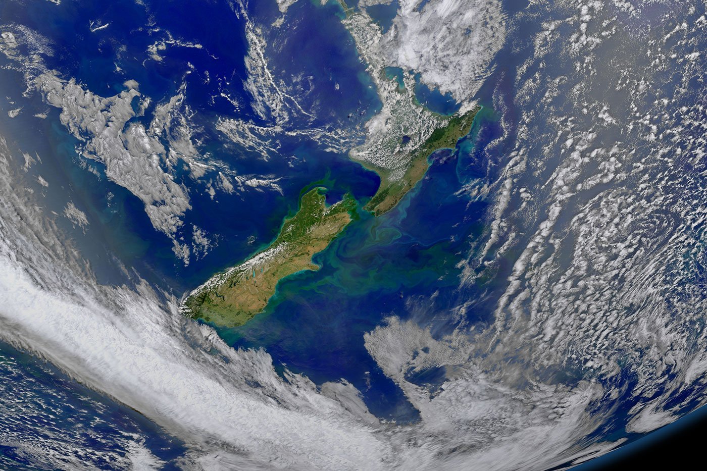
(Photo Credit: N.Mortimer/GNS Science)
However, after observing the area’s features on an underwater topography map, New Zealand geologist Nick Mortimer became convinced that Zealandia is a continent. The researcher and his team of eight scientists at GNS Science in Dunedin, New Zealand have spent the last twenty years gathering evidence to back up their belief.
In an article published in The Geological Society of America on February 9, 2017, the geologists assert that Zealandia meets all four criteria to be classified as a continent: [a] It has a higher elevation than the oceanic crust, [b] It has a unified well-defined area [c] It has a thicker crust and lower seismic velocity structure than the surrounding oceanic crustal regions, and [d] It comprises of granite, limestone, and sandstone — rocks typically found in continental crusts.
Mortimer says that while Zealandia is much smaller than our seven continents, at over half the size of Australia, it is unfair to classify it as a microcontinent. The geologist argues, “If you could pull the plug on the world’s oceans, then Zealandia would probably long ago have been recognized as a continent.”
The landmass was once part of the supercontinent Gondwana, which broke up into the modern-day Antarctica, Australia, South America, and Africa over 180 million years ago. The researchers believe that during the breakup process, Zealandia was stretched so thin that in some sections, the crust is just 7-miles thick. They speculate it is this slenderness that caused most of the landmass to sink in the ocean.
Unfortunately, not everyone is convinced Zealandia deserves to be a continent. Northwestern University geologist Christopher Scotese argues that too much of the landmass is underwater, asserting it’s “almost a continent the way Pluto is almost a planet.” Richard Ernst, a geologist at Carleton University in Ottawa, proposes coining a new term — minicontinent— for Zealandia. He thinks this is perfect given that it is too large to be called a microcontinent and too small to be classified as a full-sized continent. Given that there is no international panel to decide the fate of Zealandia, its future as a continent is uncertain. Mortimer hopes that if proponents start using the term “Zealandia,” it may eventually catch on. Whether that happens remains to be seen, but for now, we will have to be satisfied with just seven continents!
Resources: livescience.com,newatlas.com,nationalgeographic.com,sciencenew.org
